I can answer your second question:
Upper and Lower have nothing to do with drawing on a northed map, but rather with the geography of the land. The Alps start to fade out and thus get lower the more you go west in Austria so Lower Austria is physically lower than Upper Austria.
Same thing in Bavaria: The Southern part is called Oberbayern (Upper Bavaria) whereas the northern part is Niederbayern (Lower Bavaria).
I think it refers to their location in relation to the river Enns. Upper Austira was called “ob der Enns”, Lower Austria was called “nied der Enns” in the middle ages.
Well, rivers usually flow from higher to lower points, so the explanation is still somewhat correct ;)
but to be fair, that’s more the reasoning I found for myself, tieing it to rivers makes more sense in a historical context.

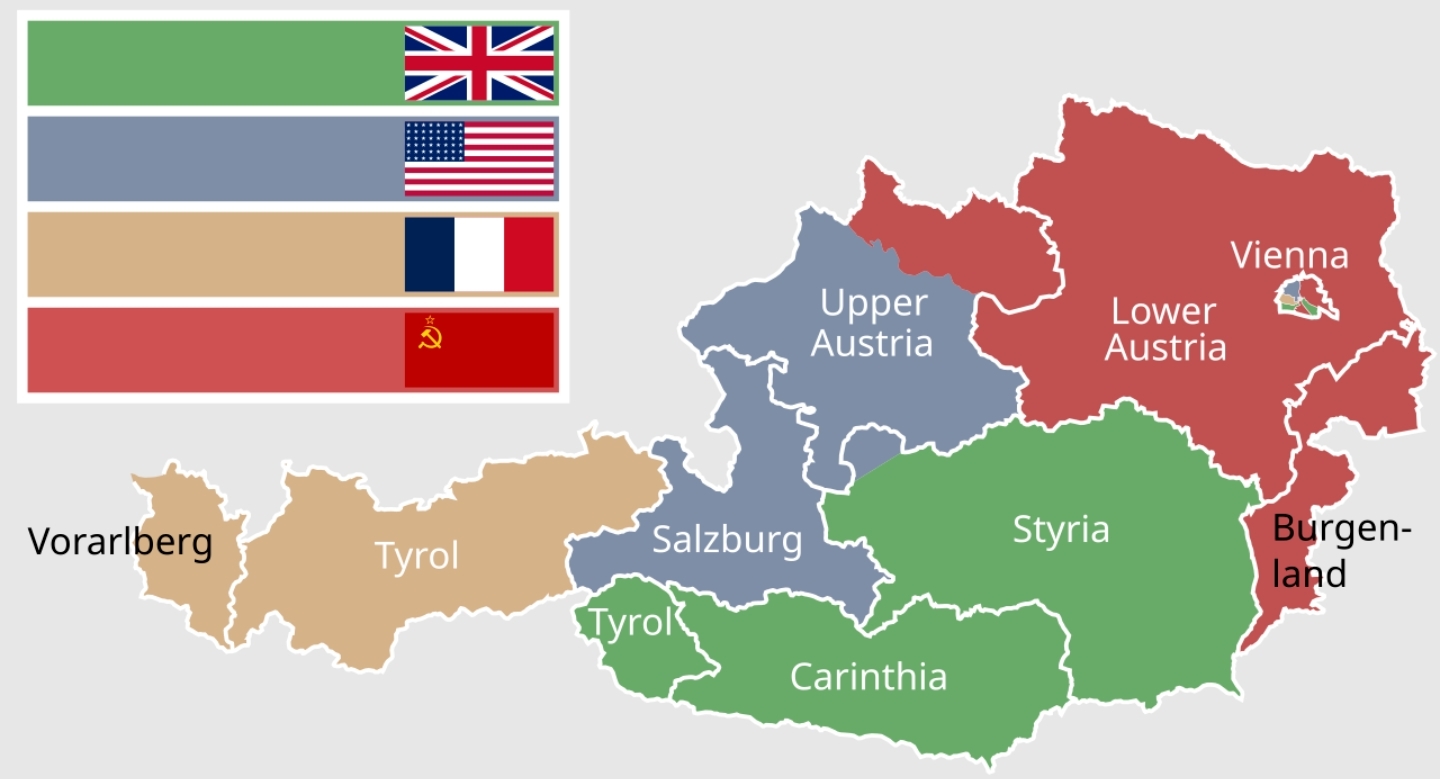
Why is upper Austria chopped into 2 pieces? And another piece added from Styria?
Also why is upper Austria lower down than lower Austria?
I can answer your second question: Upper and Lower have nothing to do with drawing on a northed map, but rather with the geography of the land. The Alps start to fade out and thus get lower the more you go west in Austria so Lower Austria is physically lower than Upper Austria. Same thing in Bavaria: The Southern part is called Oberbayern (Upper Bavaria) whereas the northern part is Niederbayern (Lower Bavaria).
Of course! Thanks!
I think it refers to their location in relation to the river Enns. Upper Austira was called “ob der Enns”, Lower Austria was called “nied der Enns” in the middle ages.
Well, rivers usually flow from higher to lower points, so the explanation is still somewhat correct ;) but to be fair, that’s more the reasoning I found for myself, tieing it to rivers makes more sense in a historical context.
The Danube flows from Upper Austria to Lower Austria, so of course Lower Austria is lower than Upper Austria.
I can’t tell you why they did it that way but Upper Austria was split along the Danube river.